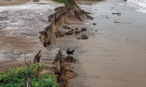
ONE of the scenarios for dealing with the impact of storm surge, combined with predicted high tides, and, in the future, sea level rise of up to 0.8 metre by 2100 is to close Cape Paterson-Inverloch Road, which the government likes to call Bunurong Road, to through traffic.
It’s part of the information contained in the long-awaited Cape to Cape Resilience Project Plan, looking at existing erosion and possible inundation in the future as a result of climate change.
“Erosion and storm tide hazards currently impact a small section of the road (Cape Paterson-Inverloch Road), at the eastern end of this location, near Bunurong Road and Surf Parade intersection. At times, temporary flooding events cut access along this section, impacting connectivity between Inverloch township and beaches, sites and properties only accessible by Bunurong Road.
“Ongoing erosion events have triggered engineering responses including a wet sand fence (2019) and rock revetment (2022).”
But the response in the future could include development controls and a targeted dune and vegetation enhancement program to improve the natural dynamics of the dune system, and provide hazard buffer.
In the case of an 0.2 metre sea level rise, the response could include the following:
* Moving infrastructure and assets out of at-risk areas over time (retreat) including redesign of road network to create local access only and loss of full coastal connection between Cape Paterson and Inverloch.
* Removal of existing coastal structures.
The Inverloch Surf Beach has been highlighted as another area of concern in the report.
“The Surf Beach is exposed to high energy open ocean south-westerly and south-easterly swells originating from Bass Strait. Headlands and offshore bedrock help to dissipate some, but not all, oncoming wave energy.
“This region will primarily be impacted by erosion and storm tide inundation. The combination of these hazards means exposure and risk are likely to increase into the future significantly,” according to the report.
In the short term, development controls, dune enhancement and drainage controls including Wreck Creek are outlined, but a rise in sea level could trigger the need for an expanded response.
With 0.5 m sea level rise (by 2070), or as a trigger is reached, the pathway expands to include:
* Moving infrastructure and assets out of at-risk areas over time (retreat) including Inverloch SLSC, Surf Parade and associated infrastructure and Surf Parade residents.
The plan considers other measures up and down the coast between Cape Paterson and Cape Liptrap but the recommendations in the plan are far from clear.
The Cape to Cape Resilience Plan sets out implementation through a range of mechanisms including:
• An effective Monitoring, Evaluation, Reporting and Improvement (MERI) approach, to enable adaptive management and ensure continual learning and improvement.
• Embedding outcomes and actions from the Resilience Plan into existing processes and activities of each RaSP agency, such as asset management programs, planning processes, policies and legislation.
• Implementing new initiatives from the Resilience Plan.
• Collaborating and coordinating with RaSP members on action delivery.
• Collaborating with State Government and advocating for collaborative delivery of actions and policy to support action delivery.
The draft plan is open for public comment for 28 days, see the full report HERE


